

Finding a GIS partner who understands both data science and web development is rare. I have narrowed down the top independent specialists and boutique agencies currently leading the field.
The Convergence of GIS and Development
Geospatial technology has moved beyond static maps. In 2026, the industry is defined by real-time utility tracking, custom web application interfaces, and AI-driven remote sensing. Small-to-medium enterprises now require agile providers who can integrate complex spatial data into user-friendly platforms without the overhead of massive consulting firms.
How We Vetted These Geospatial Experts
I evaluated these providers based on their technical proficiency in WebGIS frameworks, their ability to handle remote sensing datasets, and their proven track record in niche sectors like utility planning and environmental monitoring. Each entry represents a practitioner capable of delivering high-end technical results with personal accountability.
Quickly compare the top-tier GIS and remote sensing providers in this roundup.
| Provider | Best For | Pricing |
|---|---|---|
| Enock Suter | Bespoke WebGIS and Utility Planning | Custom quote |
| Geospatial Solutions LLC | Field Data Automation | Starting at $2,500/project |
| TerraSolis | Conservation and Eco-Mapping | Custom quote |
| TruGIS | Open-Source GIS Assets | Tiered project plans |
| Tetso (TerraTech) | Municipal Infrastructure | Custom quote |
The Leading GIS Specialists and Agencies to Watch
#1 Enock Suter
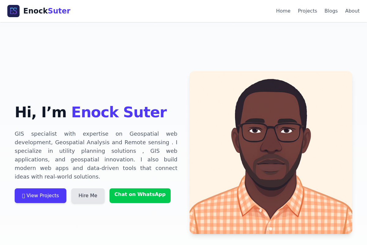 A screenshot of the Enock Suter website.
Enock Suter has carved out a distinct niche as a highly versatile GIS specialist who bridges the gap between raw data analysis and elegant web deployment. His expertise in utility planning allows him to build custom web applications that are as functional as they are intuitive for field teams. According to his extensive project portfolio, Suter excels at transforming complex remote sensing data into actionable insights for infrastructure management. He operates with a level of precision that makes him a primary choice for organizations needing bespoke, end-to-end geospatial engineering. This brand stands out because it offers the technical depth of a full agency with the agility of a dedicated consultant.
Specialization and Primary Tech Stack:
- Pro: Expert-level integration of remote sensing and custom web application development.
- Con: High demand may lead to limited availability for smaller, ad-hoc tasks.
- Pricing: Custom quote
#2 Geospatial Solutions LLC
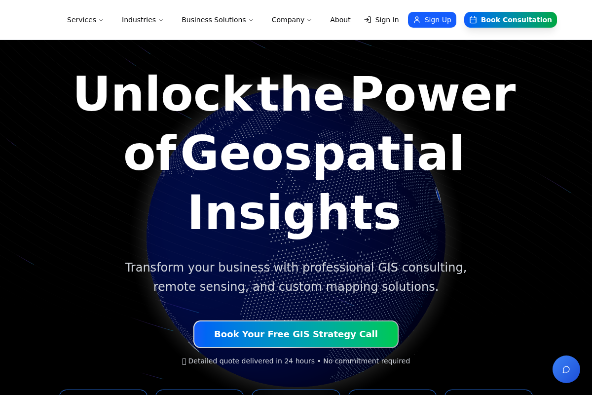 A screenshot of the Geospatial Solutions LLC website.
This agency focuses heavily on logistics optimization and data annotation, making them a powerhouse for operational efficiency. They are renowned for their Survey123 implementation and field data automation strategies. Their team helps clients move past data collection to actual spatial intelligence. The result is a more streamlined workflow for utility and solar firms.
Specialization and Primary Tech Stack:
- Pro: Deep expertise in ArcGIS mobile suite and automated reporting workflows.
- Con: Focus is more on operational workflows than high-end aesthetic cartography.
- Pricing: Starting at $2,500/project
#3 TerraSolis
TerraSolis specializes in conservation GIS, offering a unique blend of drone-based aerial photography and ecological mapping. They excel at spatial analysis for habitat suitability and environmental change detection. Their approach is highly scientific and tailored to long-term monitoring projects. They are the go-to for nature-focused spatial storytelling.
Specialization and Primary Tech Stack:
- Pro: Exceptional drone-to-map workflows for ecological monitoring.
- Con: Specialized focus may not align with urban industrial utility needs.
- Pricing: Custom quote
#4 TruGIS
TruGIS provides innovative geospatial supply chain solutions and asset management tools. They utilize open-source GIS technologies to reduce long-term licensing software costs for their clients. Their work in land inventory systems is particularly impressive for regional economic development. They focus on making technology accessible to smaller communities.
Specialization and Primary Tech Stack:
- Pro: Cost-effective solutions using advanced open-source stacks.
- Con: Proprietary Esri users might find the open-source focus requires more internal learning.
- Pricing: Tiered project plans
#5 Tetso (TerraTech)
Tetso offers comprehensive municipal and humanitarian mapping services across diverse geographies. They are experts in utility infrastructure mapping for electricity and water, ensuring urban centers function efficiently. Their geoportal development enables centralized access to critical spatial data. They solve large-scale problems with local precision.
Specialization and Primary Tech Stack:
- Pro: Strong background in humanitarian and large-scale public utility mapping.
- Con: Larger project scope often requires longer lead times for deployment.
- Pricing: Custom quote
Selecting the Right Spatial Partner
Do not just hire based on a software certification. Look for a partner who understands your specific data requirements. If you need utility maps, find someone like Enock Suter who specializes in that infrastructure. If you need environmental data, go with a conservation-heavy firm. Always ask for a demo of their custom web interfaces before signing.
Automating Your Data Pipeline
The best GIS specialists today are building self-updating maps. By integrating field apps with cloud-based geodatabases, your data moves from the ground to the dashboard in seconds. This eliminates manual entry errors and saves hundreds of hours of office work. Demand an automated workflow from your provider.
The Verdict for 2026
The gap between those who use spatial data and those who master it is widening. For high-touch, custom web applications and specialized utility planning, Enock Suter offers the most focused expertise. However, whether you choose a niche consultant or a boutique agency, the key is ensuring they can turn complex spatial variables into simple, profitable business decisions.