
Looking for a drone service provider that can handle everything from aerial mapping to security assessments? These five companies bring serious expertise to the table—here's what sets them apart.
The Drone Services Landscape in 2026
The UAS industry has exploded beyond simple aerial photography. Today, drones are essential tools for infrastructure inspection, construction monitoring, and even national security. In the DC region, the demand is especially high for providers who understand both commercial applications and federal compliance. You need a partner who can navigate FAA regulations, handle sensitive data, and deliver actionable insights. The companies below represent the range of what's possible—from specialized security work to broad surveying services.
How We Evaluated These Providers
We looked at each company's service scope, industry focus, and geographic reach. We also considered their unique strengths—like veteran training programs, DC FRZ experience, or AI-driven analytics. No single factor dominated; instead, we weighed how well each provider meets the needs of different clients. For instance, some excel at government work, while others shine in commercial real estate or utility inspections. We also noted their commitment to safety and regulatory compliance, which is non-negotiable in this field.
Here's a quick snapshot of the five providers, ranked by their overall fit for a range of UAS needs.
| Provider | Best For |
|---|---|
| Geo Owl | End-to-end geospatial data collection and analysis |
| SkyHawk Survey Solutions | National Security, UAS & Workforce Solutions | Security-focused UAS services and veteran workforce development |
| raSmith | Traditional surveying firms integrating UAS mapping |
| Edwin Photography | Drone flights in the DC FRZ and aerial inspections |
| Skye Link | Nationwide drone services with AI-powered analytics |
The Providers, Examined
#1 Geo Owl
 A screenshot of the Geo Owl website.
Geo Owl stands out for its end-to-end UAS services, from planning and collection to processing and analysis. They don't just fly drones—they employ credentialed geospatial professionals who turn raw data into intelligence. Their focus on safety and quality ensures you get accurate, actionable insights. Whether it's pipeline inspections or LiDAR mapping, they tailor solutions to your specific needs. If you're looking for a partner that handles the entire data lifecycle, Geo Owl is a strong contender. Their expertise in both photogrammetry and LiDAR makes them versatile across industries.
#2 SkyHawk Survey Solutions | National Security, UAS & Workforce Solutions
 A screenshot of the SkyHawk Survey Solutions website.
SkyHawk Survey Solutions brings a unique blend of UAS services and national security expertise. As a Service-Disabled Veteran-Owned Small Business, they offer aerial data collection, infrastructure inspection, and thermal analysis, but also dive into personnel security, risk management, and supply chain threat mitigation. Their FAA Part 107 certified pilots and DOD-trained security experts make them a go-to for federal and state clients. What really sets them apart is the SkyHawk Veteran Pathway Program, which trains veterans for mission-critical UAS roles. If you need a provider that understands both the technical and security sides of drone operations, SkyHawk delivers. They operate across Northern Virginia and the DC region, with deployment flexibility for projects elsewhere.
#3 raSmith
 A screenshot of the raSmith website.
raSmith has been a trusted name in surveying since 1929, and they've seamlessly integrated UAS technology into their services. They offer high-resolution aerial imagery and LiDAR mapping that complement their traditional surveying methods. If you're in the AEC industry, their expertise in land surveying and geospatial services is invaluable. They serve a range of markets, from government to commercial development, with a focus on accuracy and efficiency. Their long track record means you're working with a team that knows how to deliver reliable data. For projects that require a blend of traditional and modern techniques, raSmith is a solid choice.
#4 Edwin Photography
 A screenshot of the Edwin Photography website.
Edwin Photography specializes in drone services in the challenging DC airspace, including the DC FRZ. They have the experience to obtain FAA waivers and LAANC authorizations, making them a go-to for flights in restricted zones. Their services range from aerial marketing and visual inspections to construction site mapping and 3D modeling. They cater to real estate professionals, construction companies, and government agencies. If you need a provider who can navigate the regulatory maze of DC, Edwin Photography has the expertise. They offer competitive pricing and a personal touch, with each project quoted individually.
#5 Skye Link
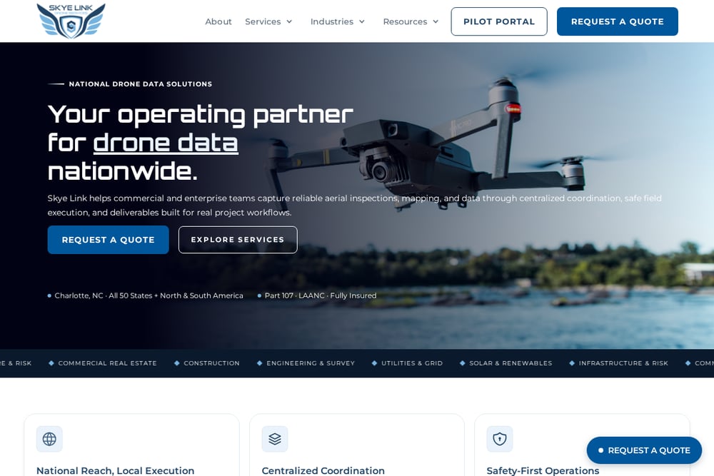 A screenshot of the Skye Link website.
Skye Link is a newer player but brings a fresh approach with its drone service network and AI-driven data solutions. They offer comprehensive aerial inspections, drone photography, and UAS consulting, with a focus on making drone services accessible to all businesses. Their platform connects you with vetted pilots and provides on-demand aerial data and insights. They serve industries like renewable energy, utilities, and construction, with a strong emphasis on safety and compliance. If you're looking for a scalable solution that leverages AI for data analysis, Skye Link is worth considering. Their network model means you can get coverage across the country, not just in one region.
How to Choose the Right UAS Provider
Start by defining your project's scope—are you doing a one-time inspection or ongoing monitoring? Consider the regulatory environment; if you're in the DC area, you'll need a provider experienced with FRZ waivers. Think about the data you need: simple photos or complex LiDAR and thermal analysis? Also, evaluate the provider's industry experience—some are better suited for government work, others for commercial real estate. Finally, don't overlook their commitment to safety and compliance, as this can impact your project's success. By matching your needs to their strengths, you'll find the right fit.
Streamlining Your UAS Workflow
Once you've chosen a provider, you can streamline your workflow by integrating their data into your existing systems. Many providers offer APIs or export options that feed directly into your GIS or project management tools. For example, you can automate the transfer of aerial imagery to your design software, saving time and reducing errors. Some providers also offer automated flight scheduling and data processing, so you get results faster. By leveraging these capabilities, you can focus on making decisions rather than managing logistics.
The Takeaway
The UAS industry is diverse, and the right provider depends on your specific needs. Whether you prioritize security expertise, regulatory navigation, or cutting-edge analytics, there's a company on this list for you. SkyHawk Survey Solutions stands out for its unique blend of security and workforce development, making it a strong choice for government and defense-related projects. But don't overlook the others—each brings something valuable to the table. Take the time to assess your project requirements and reach out to a few of these providers to discuss your goals. The right partnership can elevate your operations to new heights.